Historic maps of the
Mount Arlington NJ area
Some of these maps are presented in wide size. You may
need to scroll your page from side to side to see all the image.
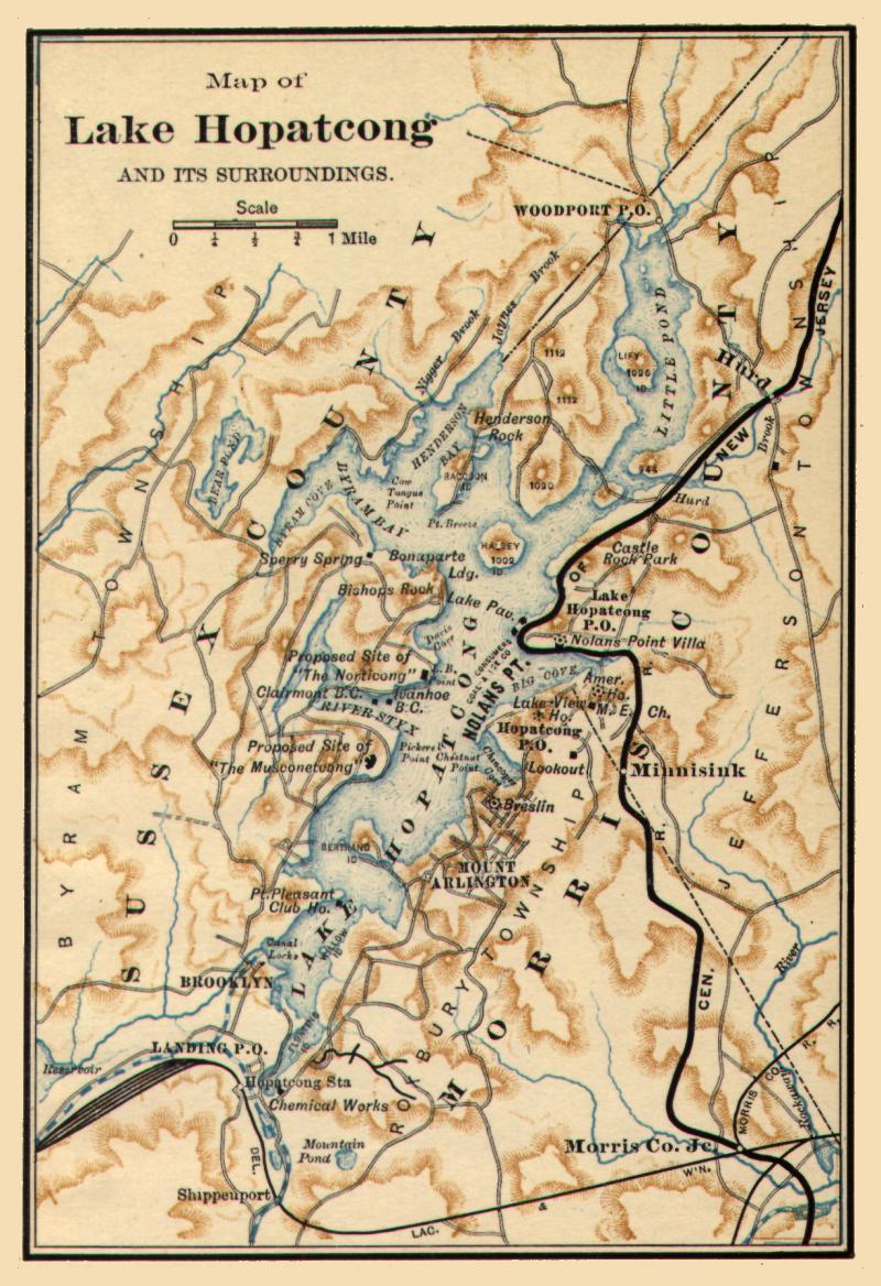
This map of Lake Hopatcong is from 1890 and was
distributed by the NJ Central Railway, their rail line is the bold black
line.
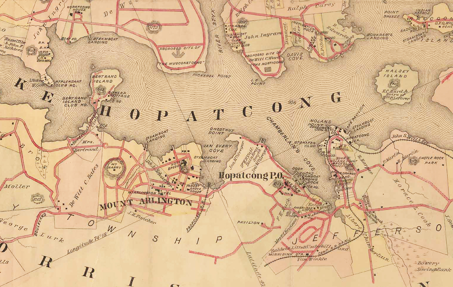
This map of Lake Hopatcong is from 1887 and is part of
the Robinson series. Mount Arlington is at the center of this excerpt,
it also includes portions of Roxbury Township, Jefferson Township and
Hopatcong. Note that some items marked as "Proposed" were never built.
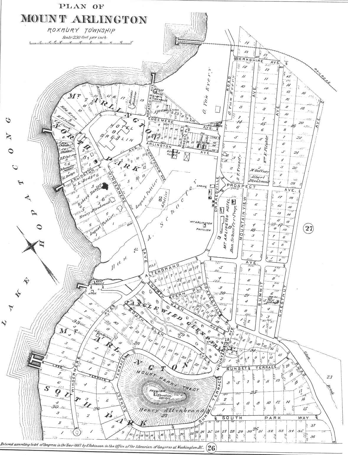
This map of Mount Arlington is from 1887 and is part of
the Robinson series. Note that some of the streets and building lots shown
on this map
are actually 1887 "Proposed" items and were never paved nor were the lots
built upon. The map was intended to promote the town.
Click here to
Return to main page
This page is a service
of MountArlington.org, a privately owned website.
A link to the "official"
Mount Arlington NJ town website can be found on the "Links" page.